Jennifer Henning's German Genealogy Site

Let me know if we are researching the same people or places.


Name and place indexes for this entire web site.

Information on just this family and region.

Introduction to this web site.
Copyright ©2005-2018 by Jennifer Henning
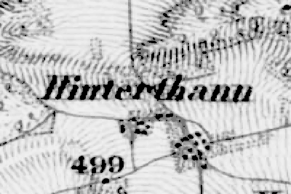
Hinterthann
Kreis Regensburg, Bayern
Related Families in Hinterthann
Navigation
Let me know if we are researching the same people or places.
Name and place indexes for this entire web site.
Information on just this family and region.
Introduction to this web site.
This page last updated September 28th, 2015, edited March 10th, 2018
Kreis Regensburg, Bayern
| |
| To zoom out to a larger area map click here. | |
|---|---|
Map dates from 1887, updated 1904. It covers an area of approximately 0.8 by 0.6 km (0.5 by 0.4 US miles).
Map image was adapted from Topographischen Bureau des K.B. 1:50K, sheet 47 (Dietfurt Ost)
The following table shows which of the individuals included in this web site are connected to Hinterthann and over what time span they are found here.
| Surname | Given names and the range of dates the person was found in Hinterthann |
|---|---|
| Engl / Engel / Engle |
 Anna Margaretha 1776..1824Anna Maria 1718Anna Maria 1734Anna Maria 1774Eva Walburga 1743Johann Georg 1747..1784Johann Georg 1734..1747Johann Joseph 1770Johann Michael 1766Joseph Georg 1781Leonard Ulrich 1737Maria Barbara 1779Maria Catherina 1767Maria Eva 1740Maria Josepa 1784Ulrich 1738 Anna Margaretha 1776..1824Anna Maria 1718Anna Maria 1734Anna Maria 1774Eva Walburga 1743Johann Georg 1747..1784Johann Georg 1734..1747Johann Joseph 1770Johann Michael 1766Joseph Georg 1781Leonard Ulrich 1737Maria Barbara 1779Maria Catherina 1767Maria Eva 1740Maria Josepa 1784Ulrich 1738 |
| Goff |
Kunigunda 1766..1784 |
| Metz |
Anna Margareta 1805Anna Maria 1809Barbara 1819Georg 1824Johann 1812..1837Johann Georg 1803..1824Johann George 1810Johann Michael 1806Walburga 1816 |