Jennifer Henning's German Genealogy Site

Let me know if we are researching the same people or places.

Name and place indexes for this entire web site.

Information on just this family and region.

Introduction to this web site.
Copyright ©2005-2016 by Jennifer Henning
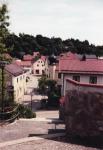
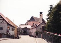
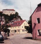
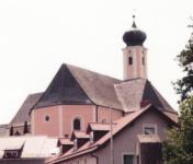
Laaber
Kreis Regensburg, Bayern
(Click on picture for larger image)
Related Families in Laaber
Navigation
Let me know if we are researching the same people or places.
Name and place indexes for this entire web site.
Information on just this family and region.
Introduction to this web site.
This page last updated April 3rd, 2014, edited October 12th, 2016
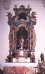
Kreis Regensburg, Bayern
(Click on picture for larger image)
| |
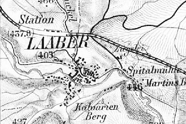
| To zoom out to a larger area map click here. | |
|---|---|
Map dates from 1887, updated 1910. It covers an area of approximately 1.9 by 1.3 km (1.2 by 0.8 US miles).
Map image was adapted from Topographischen Bureau des K.B. 1:50K, sheet 48 (Regensburg West)
The following table shows which of the individuals included in this web site are connected to Laaber and over what time span they are found here.
| Surname | Given names and the range of dates the person was found in Laaber |
|---|---|
| Huber |
 Maria Barbara 1808..1812 Maria Barbara 1808..1812 |
| Karl |
Johannes Evangelist Jacob 1808 Michael 1812Michael 1808..1812 Michael 1812Michael 1808..1812 |
| Schramm |
Barbara 1874..1891 |
| Sinzinger |
Alois 1891..1892Barbara 1886Franziska 1887Georg 1874Johann 1875Johann Baptista 1874..1891Josef 1877Josef 1879Walburga 1904Wolfgang 1885 |