Jennifer Henning's German Genealogy Site

Let me know if we are researching the same people or places.


Name and place indexes for this entire web site.
Information on just this family and region.

Introduction to this web site.
Copyright ©2005-2016 by Jennifer Henning
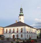
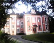
Freiwaldau
(now Jesenik)
Kreis Troppau, Austrian Silesia
(Click on picture for larger image)
Related Families in Freiwaldau
Navigation
Let me know if we are researching the same people or places.
Name and place indexes for this entire web site.
Information on just this family and region.
Introduction to this web site.
This page created February 4th, 2008, last updated November 25th, 2016
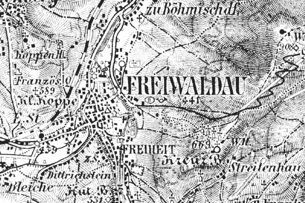
Kreis Troppau, Austrian Silesia
(Click on picture for larger image)
| |
| To zoom out to a larger area map click here. | |
|---|---|
Map dates from 1914. It covers an area of approximately 3.8 by 2.5 km (2.4 by 1.6 US miles).
Map image was adapted from Austrian 75K series, sheet 3958
The following table shows which of the individuals included in this web site are connected to Freiwaldau and over what time span they are found here.
| Surname | Given names and the range of dates the person was found in Freiwaldau |
|---|---|
| Prohaska |
 Magdalena 1817..1821 Magdalena 1817..1821 |
| Strnad(t) |
 Albert 1819..1826Karoline 1821Leopold 1817..1821Maria Magdalena 1817Theresia 1817 Albert 1819..1826Karoline 1821Leopold 1817..1821Maria Magdalena 1817Theresia 1817 |