Jennifer Henning's German Genealogy Site

Let me know if we are researching the same people or places.

Name and place indexes for this entire web site.
Information on just this family and region.

Introduction to this web site.
Copyright ©2005-2016 by Jennifer Henning
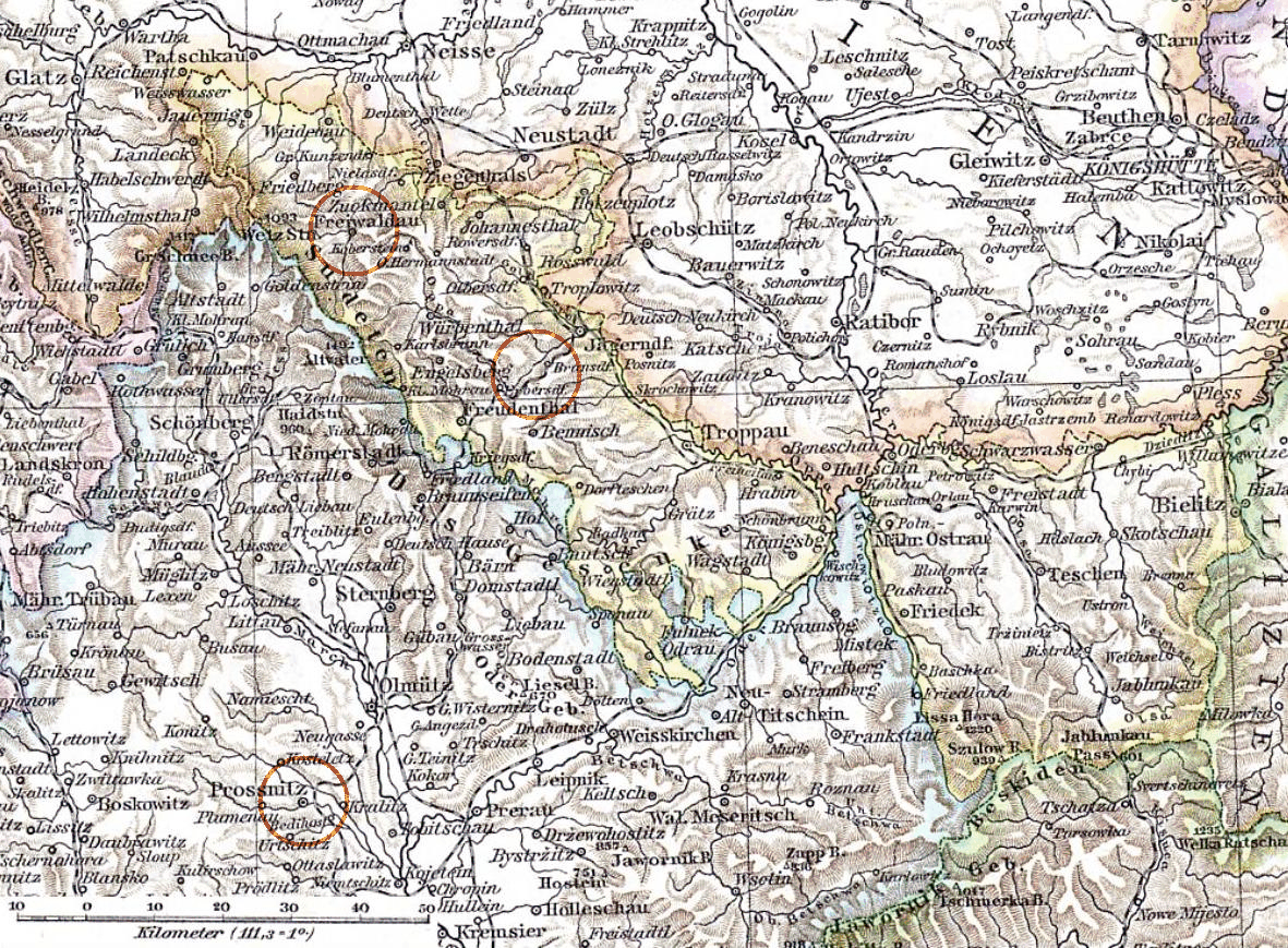
Austrian Silesia
Map published by Richard Andreea.
Navigation
Let me know if we are researching the same people or places.
Name and place indexes for this entire web site.
Information on just this family and region.
Introduction to this web site.
This page created November 25th, 2016
Map published by Richard Andreea.
| |
| To zoom in to a more detailed map, click within any Gold Circle on the above map. | |
|---|---|
Map dates from 1880. It covers an area of approximately 254 by 187 km (158 by 116 US miles).
Map image was adapted from https://en.wikipedia.org/wiki/Austrian_Silesia